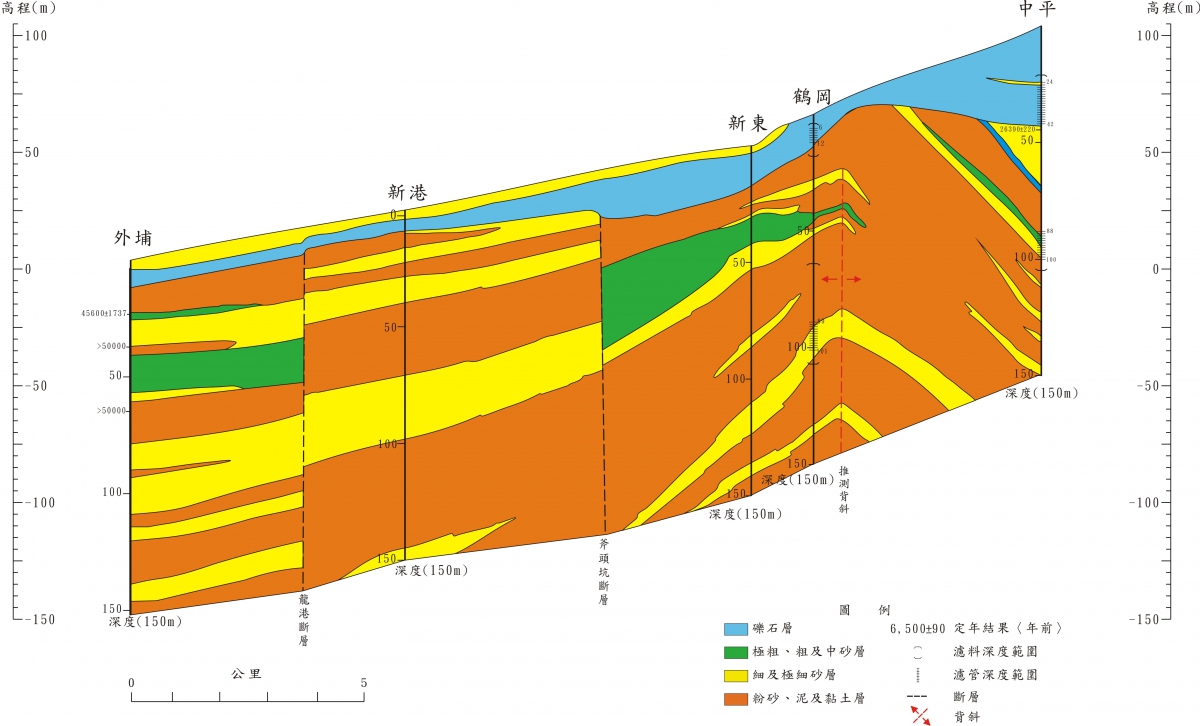
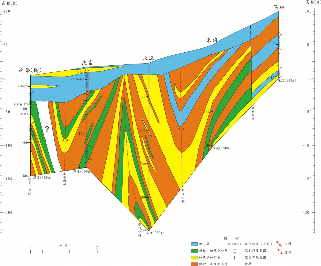
The main rivers in the coastal area of Miaoli Hsinchu include Fengshan Stream, Touqian Stream, Zhonggang Stream, Houlong Stream and Daan Stream. The main terrain in the territory is mainly terraces, hills and alluvial plains. The larger alluvial plains are located downstream of the main rivers, while the upstream areas are valley plains with a width of less than 5 kilometers. Alluvial layers with groundwater resources are mostly distributed in the main The valley downstream of the river. The alluvial plain is composed of Holocene alluvial layers. The thickness of the alluvial layer is quite thin, mostly only more than 20 meters, and is limited to both sides of the river channel. The alluvial layers of different water systems are not connected, so the hydrological system is more complicated; and the platform or hills The sediments in the area are affected by diagenesis, and there is a slight cementation phenomenon, which belongs to the stratum of the Pleistocene Jishan layer. Both are mainly composed of gravel and sand and mud interbed. Geological structures are widespread in the Xinmiao area, which also affects the distribution and complexity of the groundwater system; the groundwater resources in this area are relatively abundant.
The hydrogeological structure of the Linhai area in Miaoli, Hsinchu can be divided into shallow and deep groundwater layers. The shallow groundwater layer contains Holocene alluvial layers, sand dunes and later red Pleistocene gravel layers, and is less affected by faults or structures. The groundwater layer is horizontally distributed, and the main source of recharge is rainwater or stream water. The deep groundwater layer contains the Ptoocene Tou Mountain formation. Due to the influence of tectonic action, many independent small systems have been formed. The source of groundwater recharge is mainly from upstream rivers or foothills. The strata dominated by mud or very fine sand in the area are classified as Aquitard due to their extremely low permeability coefficient.

Figure 6.2-2 Touqianxi hydrogeological profile

Figure 6.2-3 Houlongxi Hydrogeological Section
References: "Compilation of the results of the overall plan of the Taiwan Groundwater Observation Network (81-97)"
Hydrogeology
Xinmiao Hydrogeological Environment


