

The Huadong Rift Valley is mainly formed by alluvial deposits such as Huaxi Stream, Xiuguluan Stream and Beinan Stream; the source of its accumulation is mainly metamorphic rocks in the central mountains in the west and igneous rocks and sedimentary rocks in the coastal mountains in the east. The three major water systems in the Rift Valley. According to the geographical location and hydrogeological distribution, the Huadong Rift Valley can be divided into 3 subdivisions: Hualien Plain Area, Rift Valley Area, and Taitung Plain Area.
The Hualien Plain area is a compound alluvial fan skirt area formed by the alluvial flow of the three streams such as Papaya Creek, Ji'an Creek and Meilun Creek from the Central Mountain Range. During the Holocene advancing period, it transformed into a braided river system and/or meandering river system. Sedimentary phases of finer particles such as environment. It was only at the uppermost part, about six thousand years ago, that the area was affected by the expansion of alluvial fans, mainly with gravel sediments.
Under the influence of tectonic and alluvial fan accumulation, the groundwater layer of the Hualien Plain can be divided into three areas. The northernmost Xincheng is a huge thick groundwater layer that connects up and down; Beipu at the northern end of the Hualien Plain has only an upper groundwater layer of 25 meters; The Hualienping principle can be divided into an upper groundwater layer and a lower groundwater layer, and the thickness of the groundwater layer gradually decreases toward the sea side.
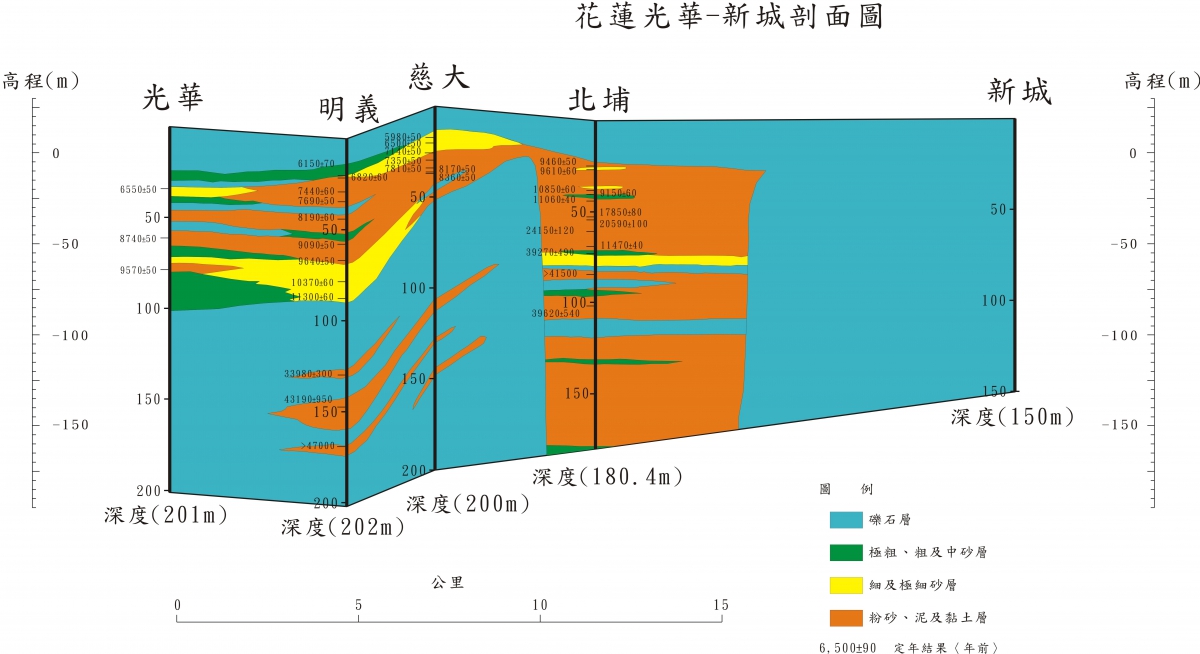
Figure 12.2-1 Geological profile from Xincheng to Guanghua
The Taitung Plain is mainly formed by the alluvial deposits of Beinan Daxi, Taiping, Lijia and Zhiben streams. Based on the analysis of its sedimentary environment, the Taitung Plain is mostly dominated by gravel deposits, indicating that they are deposited in the alluvial fan environment at the front of the foothills. Among them, Toyota and Kangle are maintained in an alluvial fan environment from bottom to top. Fenglijing is formed by the alluvial alluvium of Tainan Plain, Taiping Stream, Lijia Stream and Zhiben Stream in the alluvial fan environment. It was 55 meters deep (approximately 7000-8000 years ago). It was once transformed into a meandering river environment, and then was affected by the expansion of alluvial fans, mainly with gravel sediments. In the Taitung Plain, except for the Fuxing Well drilling on the base plate, the sedimentary facies are mostly alluvial fan gravel layer, which is basically a huge thick groundwater layer without obvious water blocking layer.
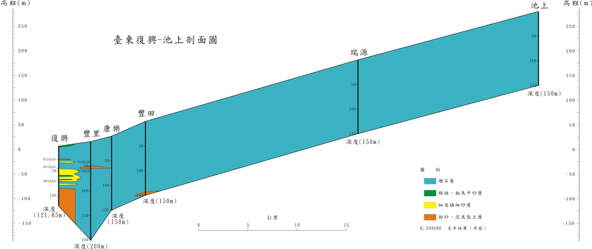
Figure 12.2-2 Geological profile from Chishang to Fuxing
Sedimentary facies in the Huadong Rift Valley are the alternating changes between the river channel deposits and the alluvial fan deposits, which are mainly formed by the alluvial fans accumulated by the tributaries of the central mountain range and the coastal mountain range on both sides of the longitudinal valley, and are formed by cutting and transporting the main channel of the longitudinal valley. Due to the high transport energy of the river and the coarse sediment particles, no obvious environmental changes were shown. The Huadong Rift Valley can be regarded as a huge thick groundwater layer without obvious stratification.
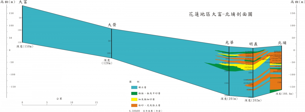
Figure 12.2-3 Geological profile from Beipu to Dafu
references:
"Compilation of the results of the overall plan for the groundwater observation network in Taiwan (1992-2008)"