

5. Radar interferometry (InSAR): The main purpose is to monitor large-scale surface deformation through satellite images taken at different times in the same location. The mechanism is based on the SAR images taken by two microwave satellites in the same area as the basic processing data. Through the phase difference of the two SAR images, the interference image is obtained, and then the phase is unwrapped to obtain the terrain elevation data from the interference fringes. .
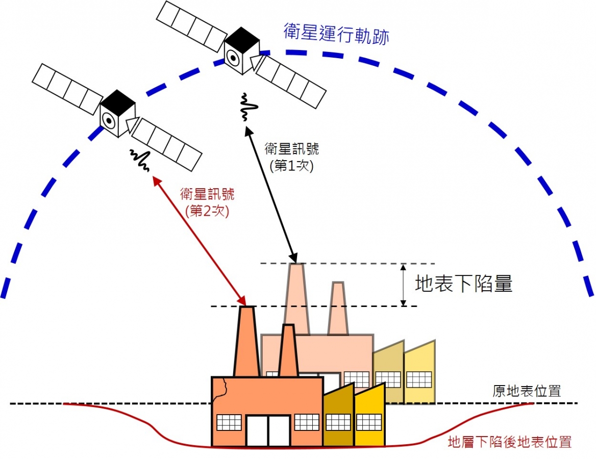
DInSAR量測示意圖